

Division into map sheets of the State map 1 : 5,000 at the scale 1: 500,000
| Product information | ||
|---|---|---|
 | Name | Division into map sheets of the State map 1 : 5,000 at the scale 1: 500,000 |
| Commercial code | 63251 | |
| Export unit | Czech Republic | |
| Unit price | According to Regulation No 31/1995 Sb. | |
| Export formats | TISK | |
| Coordinate systems | S-JTSK / Krovak East North | |
| Distribution | 
| |
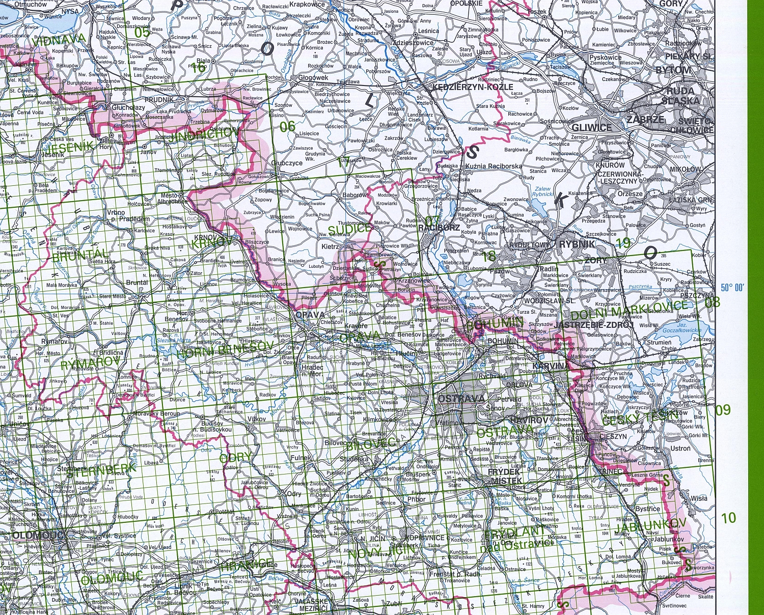
| Product description | Division into map sheets of the State map 1 : 5,000 (KSM 5) allows the localization of individual map sheets of the State Map 1:5,000 (SM 5) using graphically suppressed content of the Map of the Czech Republic 1: 500,000. Map layout consists of the system of neat lines which indicates the relative position and identification of individual map sheets of the State Map 1:50,000 (StM 50) and a location of SM 5 map sheets. Map lettering includes standard geographical names, spot heights (altitude), names of StM 50 map sheets, tirage data, data of graphic scale, text part of map legend and frame data (geographical coordinates). Map legend includes division of StM 50 map sheet into SM 5 map sheets, limitation and examples of designation and numbers of StM 50 and SM 5 map sheets and delimitation of SM 5 map sheets. The subjects of topographic content of KSM 5, with the exception of national administrative boundaries, are shown also on adjacent parts of the neighboring countries territory. In the overview of map layout neat lines are only in the neighboring countries territory of the map sheets which contain the Czech Republic territory. | |
| Update cycle - update state | The last edition of the map is from 2008. | |
| Conditions applying to access and use | According to Regulation No 31/1995 Sb. | |
| View data | ||
| Data download | ||
| Contact - product information | Czech Office for Surveying, Mapping and Cadastre, e-mail: prodejna.map.praha@cuzk.cz | |
Product last update:
2008-12-31
2008-12-31
Information last update:
2023-06-30
2023-06-30
 RSS 2.0 Geoportal ČÚZK